
Let's talk
In today’s fast-moving construction and inspection industry, accuracy is everything. Traditional survey methods often involve manual measurements, scaffolding, and long inspection times, which increase the risk of errors and delays. This is where modern drone technology is transforming the process. Advanced drone surveys provide precise data, faster results, and safer inspections for construction, roofing, and infrastructure projects across the Dubai.
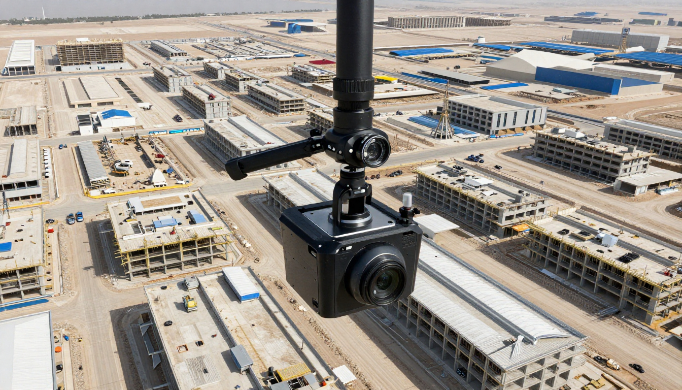
Drone surveys use high-resolution cameras, GPS systems, and intelligent mapping software to capture accurate aerial data. These surveys eliminate guesswork and provide real-time insights into project conditions. Whether it is land measurement or roof analysis, drones ensure consistent and reliable results.
Services such as drone roof surveys are now widely used to inspect residential, commercial, and industrial buildings. Instead of relying on manual access, drones capture detailed roof imagery within minutes, reducing inspection time and improving reporting accuracy.
Drones capture high-quality aerial images and videos from multiple angles. This allows surveyors to detect structural issues, surface damage, and alignment errors that are often missed during manual inspections. With Air tech aerial drone survey UAE services, project teams receive accurate geospatial data that supports better planning and execution.
Roof inspections are one of the most challenging tasks in construction and maintenance projects. Using drone building roof inspection surveys, professionals can closely analyze cracks, leaks, drainage problems, and material wear without physically accessing the roof. This results in safer inspections and highly accurate condition assessments.
Drone surveys provide updated visuals of project progress, allowing teams to compare current site conditions with original plans. This helps identify deviations early and reduces costly rework. Accurate progress tracking also improves coordination between stakeholders.
Manual measurements are prone to mistakes, especially on large or complex sites. Drone technology automates data capture and processing, significantly reducing human error. Accurate 3D models and maps support informed decision-making throughout the project lifecycle.
Drone surveys cover large areas in less time compared to traditional methods. This efficiency reduces labor costs and minimizes project downtime. Businesses in the UAE increasingly rely on drone roof surveys and aerial inspections to achieve faster turnaround times without compromising accuracy.
With aerial drone survey Dubai services, companies can ensure compliance, accuracy, and efficiency in every phase of their projects.
Drone surveys have become an essential tool for improving project accuracy in construction and inspection work. From drone building roof inspection surveys to large-scale aerial mapping, drones deliver precise data, enhanced safety, and faster results. By adopting drone technology, businesses can reduce risks, improve accuracy, and maintain full control over project outcomes.

Let's talk